Overview
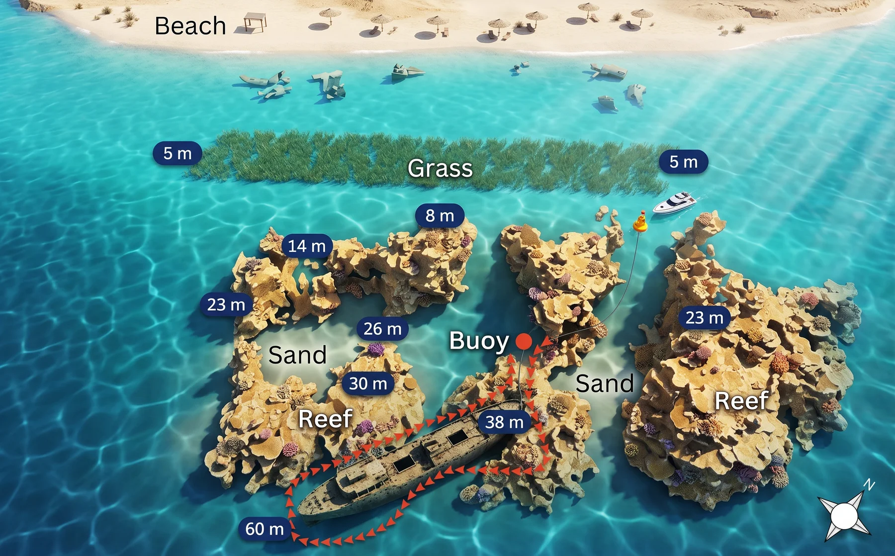
The Al Shorouk has barely changed since she went down in 2008, and depth is the reason. Her bow lies at 38 m and her stern at 55 to 60, too deep for the light that drives the growth which has buried every other wreck in Aqaba, so she still reads as a ship rather than as reef: plating clean, edges sharp, corrosion slight. She was built in Haifa in 1967 as a landing craft of 45 by 15 m and went through four names before this one, the last two Aqaba Star and Nour 3. Aqaba Marine Park scuttled her on June 18, 2008 and renamed her Al Shorouk, sunrise, for the new beginning they wanted for diving here.
Dive plan
The scuttling very nearly failed. As she went down she began to drift toward water more than 100 m deep, and she was pushed back into divable depth in the last minutes before she slipped under; the site exists at all because of those minutes. She lies on her starboard side straddling two reefs. A buoy on the bow leads to the shallowest point at 38 m, and the usual profile runs the bow and superstructure first, then aft along the hull with the stern at 55 to 60 m as the limit. The bridge and the engine room are both open, and there is a swim-through beneath the hull for divers equipped for it. Every dive here is a staged decompression dive, which is the whole difference between this wreck and the rest of the Aqaba list.
What to see
There is far less growth on her than on the shallow wrecks up the coast, and that is the point of the site rather than a shortcoming: this is what the others looked like before the reef took them. Invertebrates hold the interior spaces and the sheltered plating. Large groupers and snappers work the hull, lionfish and moray eels sit in the structure, and schooling reef fish move over the two reefs the ship came to rest on. Rays and turtles pass through.


Dive sites nearby
Reviews & comments
Please, sign in to leave a review
Continue with a social account - yours will be created automatically.
No reviews yet — be the first.